
TOPO State Series
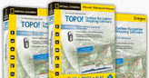
The leading outdoor recreation TOPO! software for more then 10 years. Available in 28 individual state and multi-state packages covering the entire United States. Compatible with PC, Mac, and most GPS receivers.
With TOPO!, you can:
| Connect to your GPS, transferring routes, waypoints, and tracks. | |
| Draw your own trails, calculate distances, and visualize terrain. | |
| Customize your maps with photos, symbols, and text. | |
| Fly your trail in 3D to see the lay of the land. | |
| Keep your maps updated, with a free built-in service. | |
| Print detailed , with your customization, scale bars, and navigation aids. |
Every TOPO! package includes five TOPO! levels:
| Two National Geographic Atlas for the big picture. | |
| USGS 1:500,000-scale to help you hone in on your destination | |
| USGS 1:100,000-scale topographic , ideal for planning and visualizing long trips. | |
| USGS 1:24,000-scale topographic for fine detail. |
Unlike TOPO! sets that cover the entire country in one box, TOPO! uses genuine USGS topographic maps, scanned at high resolution and seamlessly tiled together. This unique process creates the highest detail possible, essential for quality prints, navigation, and outdoor safety.
We Normally only stock the North and South Carolina sets, but any others can be obtained in 10 days or less.
Water proof Adventure paper is also available for printing your own tops so they will not run when they get damp. Available in boxes of 25 sheets.
Pricing
| Description | SKU # | Price |
|---|---|---|
| NC, SC TOPO Software | DT-5001 | $99.95 |
| Water Proof paper pack of 25 | DT-5002 | $19.95 |